


Track and time this hike using a mobile device!
TRACK AND TIME YOUR HIKE
West Vancouver Seawall
 Directions to West Vancouver Seawall
 Download offline KML trail map of West Vancouver Seawall

Dundarave, West Vancouver
49.327006, -123.162350
7°c Clear Sky Humidity: 48% Sunrise: 6:11 am
Track and hike this trail on your mobile device!
Total Distance
(One Direction)
(One Direction)
Total Ascent

Elevation Profile
Trail Description
The West Vancouver Seawall, also commonly known as the West Van Sea Walk and officially known as the Centennial Seawalk offers beautiful views of the North Shore mountains, Burrard Inlet, Lions Gate Bridge, and Stanley Park. Be wary of high tourist traffic on afternoons and weekends. Off-leash dogs are permitted in a separate fenced-in portion of the trail.
Photos of West Vancouver Seawall (3)

 Add your own photos
matthew.inouye
Mar 11th 2018
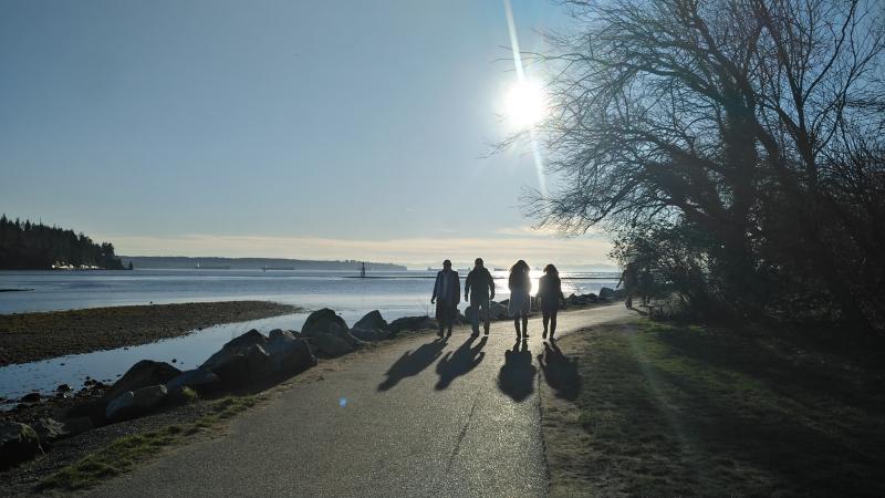
In the dog off leash area
matthew.inouye
Mar 11th 2018
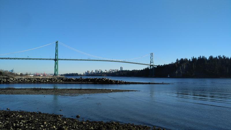
View of Lions Gate bridge from the seawall
matthew.inouye
Mar 20th 2018
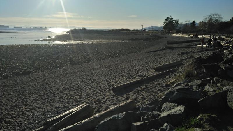
Beach
Download Free KML Trail Map for West Vancouver Seawall
 West Vancouver Seawall is equipped with a free downloadable offline trail map that can used in Google Earth, Google Maps/KML enabled cell-phone or in a GPS device.
Download KML trail map
West Vancouver Seawall is equipped with a free downloadable offline trail map that can used in Google Earth, Google Maps/KML enabled cell-phone or in a GPS device.
Download KML trail map
Trails near West Vancouver Seawall
Capilano Pacific Trail 1.9 km away
Spirit Trail Phase One 2.2 km away
North Shore to East Van Bike Route 2.4 km away
Beaver Lake Loop 3.1 km away
Stanley Park Seawall 3.5 km away
Top Trail Times
| # | Hiker | Date | Start Time | Duration |
Comments
