


Track and time this hike using a mobile device!
TRACK AND TIME YOUR HIKE
Crystal Falls Trail
 Directions to the Crystal Falls Trail
 Download offline KML trail map of Crystal Falls Trail

Coquitlam
49.295657, -122.771102
7°c Overcast Clouds Humidity: 71% Sunrise: 6:02 am
Track and hike this trail on your mobile device!
Total Distance
(Return)
(Return)
Total Ascent

Elevation Profile
Trail Description
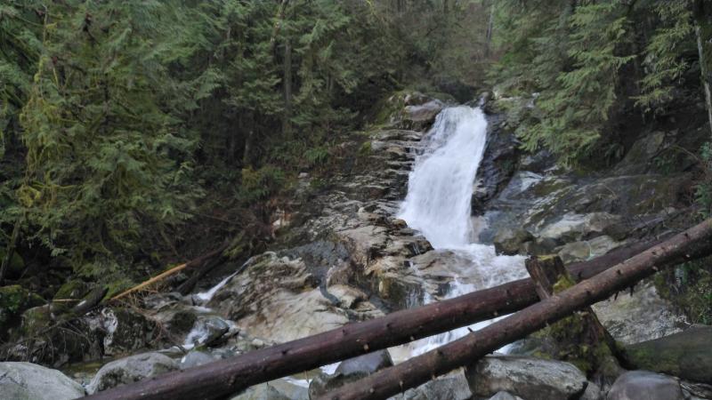
The Crystal Falls trail is a popular trail that follows Coquitlam River north to a waterfall where Prichett Creek meets the Coquitlam River. The trail is popular for it's close vicinity to the city center, that it is fairly easy to hike, with minimal elevation changes and a wide path. Areas of the trail are occasionally flooded and there are often temporary, brief detours available. Portions of the trail at the beginning have started to erode into the Coquitlam River and can be slippery or dangerous.
It is not a City-sanctioned trail and a stretch of the trail crossed into private property. As of early 2021, private-owned sections have been blocked and the trail can no longer be completed. There are alternative ways to reach the Crystal Falls via the Pinecone Burke Mountain Park to the east. However, those trail conditions are significant different.
Photos of the Crystal Falls Trail (1)

 Add your own photos
matthew.inouye
Feb 26th 2018
View of the falls
Tags
Download Free KML Trail Map for the Crystal Falls Trail
 The Crystal Falls Trail is equipped with a free downloadable offline trail map that can used in Google Earth, Google Maps/KML enabled cell-phone or in a GPS device.
Download KML trail map
The Crystal Falls Trail is equipped with a free downloadable offline trail map that can used in Google Earth, Google Maps/KML enabled cell-phone or in a GPS device.
Download KML trail map
Trails near the Crystal Falls Trail
Coquitlam River Trail 390 meters away
Ridge Park Loop Trail 2.2 km away
Burke Ridge Trail 2.6 km away
Hoy Creek Trail 3.2 km away
Coquitlam Crunch Trail 3.4 km away
Top Trail Times
| # | Hiker | Date | Start Time | Duration |
| 1 | Matthew Inouye | Feb 10, 2018 | 08:33:56 | 00:39:58 |
| 2 | Matthew Inouye | Apr 29, 2020 | 15:29:00 | 01:17:18 |
| 3 | Yuen Chow | Apr 29, 2020 | 15:29:34 | 01:17:29 |
| 4 | Yuen Chow | May 7, 2020 | 16:44:24 | 01:31:33 |
Comments
