


Track and time this hike using a mobile device!
TRACK AND TIME YOUR HIKE
Shoreline Trail
 Directions to the Shoreline Trail
 Download offline KML trail map of Shoreline Trail

Rocky Point, Port Moody
49.281510, -122.849826
8°c Light Rain Humidity: 87% Sunset: 8:21 pm
Track and hike this trail on your mobile device!
Total Distance
(One Direction)
(One Direction)
Total Ascent
Trail Description
Due to COVID-19, this trail is now one way heading east where the gravel trail starts near the dog offleash park.
The Shoreline trail in Port Moody is a popular urban route used by locals and tourists to hike, jog and walk along the marsh and sandy flats at the eastern end of the Burrard Inlet.
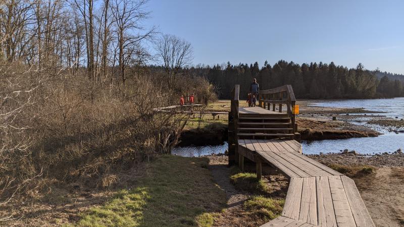
The Shoreline trail offers a variety of terrain including an elevated boardwalk over the marsh, gravel paths and forest floor. Because of it's unique location, the trail also offers views of Mount Seymour, the Burrard Inlet, Eagle Ridge and Burnaby Mountain.
The trailhead is at the Rocky Point Pier at the north end of Rocky Point Park and heads east, following the shoreline to the north end of the inlet. It loops back onto another trail at the site of the old Lion Lumber Company at Old Orchard Park.
As the trail is very popular and Brewery Row is nearby, parking is very difficult to find. However, the trail is within a short walking distance from both the Inlet Centre and Moody Centre SkyTrain Stations. Restrooms are available at the park facilities at Rocky Point Park. Some areas of the trail are bike friendly. There is an alternate and wider route on the west end of the the Shoreline trail if you plan to bike and wish to avoid the narrow areas near Rocky Point.
Photos of the Shoreline Trail (3)


 Add your own photos
matthew.inouye
May 27th 2020
Sunset from the Old Mill Site
matthew.inouye
May 27th 2020
Sunset from the Old Mill Site
matthew.inouye
May 27th 2020
View of the Boardwalk over the marsh
Download Free KML Trail Map for the Shoreline Trail
 The Shoreline Trail is equipped with a free downloadable offline trail map that can used in Google Earth, Google Maps/KML enabled cell-phone or in a GPS device.
Download KML trail map
The Shoreline Trail is equipped with a free downloadable offline trail map that can used in Google Earth, Google Maps/KML enabled cell-phone or in a GPS device.
Download KML trail map
Trails near the Shoreline Trail
Noons Creek Trail 1.3 km away
Bert Flinn Trail 1.9 km away
Coquitlam Crunch Trail 2.5 km away
Mundy Park Perimeter Trail 3.2 km away
Hoy Creek Trail 3.3 km away
Comments
